


Track and time this hike using a mobile device!
TRACK AND TIME YOUR HIKE
Mundy Park Perimeter Trail
 Directions to the Mundy Park Perimeter Trail
 Download offline KML trail map of Mundy Park Perimeter Trail

Mundy Park, Coquitlam
49.254585, -122.833800
10°c Few Clouds Humidity: 45% Sunset: 8:08 pm
Track and hike this trail on your mobile device!
Total Distance
(Return)
(Return)
Total Ascent
Trail Description
The Perimeter Trail spans all four corners of Mundy Park. Look for the steep portion on Heart Attack Hill north of Mundy Lake and just south of Lost Lake on the east end of the Park.
Mundy Park is located on the corner of Como Lake Rd and Mariner Way in Coquitlam just north of Highway 7.
Photos of the Mundy Park Perimeter Trail (1)

 Add your own photos
matthew.inouye
Mar 3rd 2018
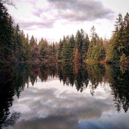
Lake at Mundy Park
Download Free KML Trail Map for the Mundy Park Perimeter Trail
 The Mundy Park Perimeter Trail is equipped with a free downloadable offline trail map that can used in Google Earth, Google Maps/KML enabled cell-phone or in a GPS device.
Download KML trail map
The Mundy Park Perimeter Trail is equipped with a free downloadable offline trail map that can used in Google Earth, Google Maps/KML enabled cell-phone or in a GPS device.
Download KML trail map
Trails near the Mundy Park Perimeter Trail
Traboulay PoCo Trail 2.9 km away
Shoreline Trail 3.2 km away
Hoy Creek Trail 3.3 km away
Noons Creek Trail 3.6 km away
Coquitlam Crunch Trail 3.7 km away
Comments
